Drone photography and video allows you to collect valuable information about your properties that you can act on and make decisions on.
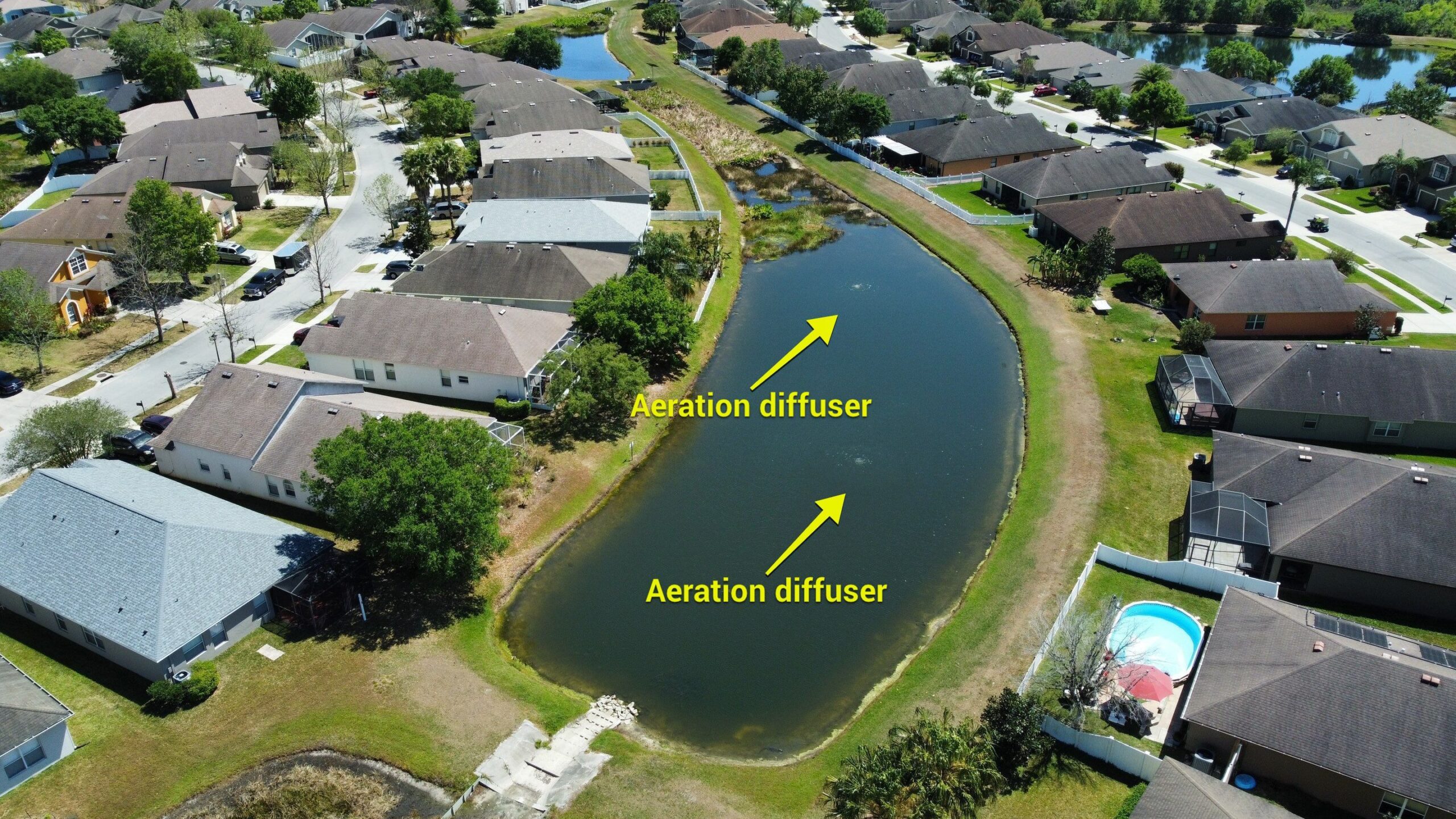
Aerial views allow you to see all your waterways, mitigation areas, wetlands and surrounding buildings or structures, and assists in detecting erosion risks or areas needing attention.
Additionally, Blue Water Aquatics drone operators utilize this technology to obtain more accurate pond measurements and pinpoint possible problem areas.
What is Drone Surveying and Mapping?
Drone surveying and mapping is a fast and efficient way to conduct land surveys with increased accuracy and safety.
Drones can capture high-resolution images and data in a fraction of the time it would take to conduct a ground survey, and can access hard-to-reach areas.
Drones are versatile and can be used for a wide range of applications, including mapping, surveying, monitoring, and inspection.
Drones capture data from an elevated viewpoint, providing a comprehensive overview of the surveyed area.
How Blue Water Aquatics Uses Drones for Site Surveys & Mapping
Blue Water Aquatics utilizes drone technology to survey difficult to reach sites such as mitigation areas, wetlands and large properties.
It makes monitoring our work progress easier and provides our customers with visual data.